
IHS Markit
The Conduit for IHS Markit maintains a local copy of IHS’s permit, completion, rig, lease, production, and well data. All this information is available in our custom Well Finder application designed for fast searching and exporting of the data. This simple to use and intuitive application is available for your entire company without the need for individual logins. We also provide the data designed specifically for Esri’s ArcMap, Tibco’s Spotfire, and Microsoft’s Excel, complete with ready-to-run templates built using SQL Server native spatial geometries.
Conduit Well Finder Application for IHS Markit
Conduit Well Finder for IHS Markit
It is easy to see why everyone loves our Conduit Well Finder. This is your single source for searching all your entitled IHS Markit data backed by daily updates. There simply isn’t a better way to query, view, and export large amounts of data. Conduit Well Finder includes custom aggregations of completion and production data that are analytics-ready in the form of our Production Abstracts (for both entity and well level) and our Well Treatment Abstracts.

Well Finder’s State Module
The Well Finder provides a direct link between IHS Markit data and Oil & Gas State Regulatory agency websites. These include direct loading of specific documents, logs, production entities, and wells within each state website. Where available, direct links to the state’s maintained web mapping sites are included.

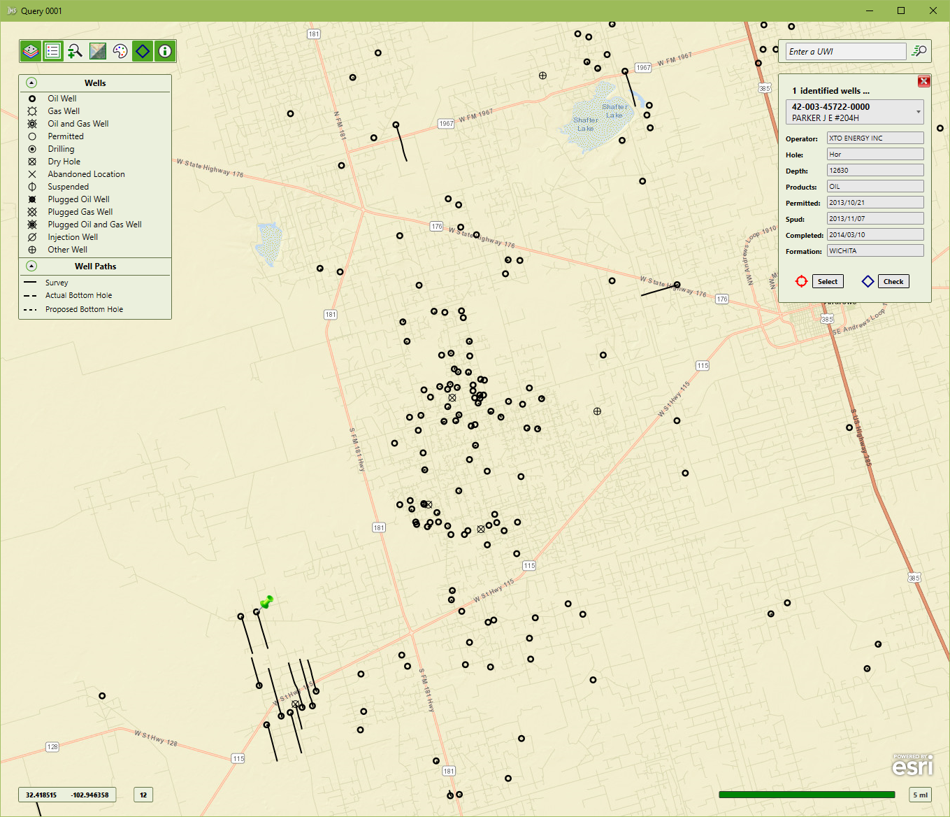
Well Finder Mapping
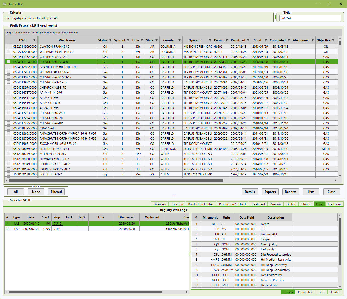
Well Finder and Log Finder Integration
When you run our Well Finder and Well Log Registry simultaneously, you gain the advantage of seeing all your proprietary logs and metadata for your IHS Markit query selection. We automatically integrate your Well Log Registry information with IHS Markit data within Well Finder.
Well Finder FracFocus Integration

Conduit Systems of Access Designed for IHS Markit
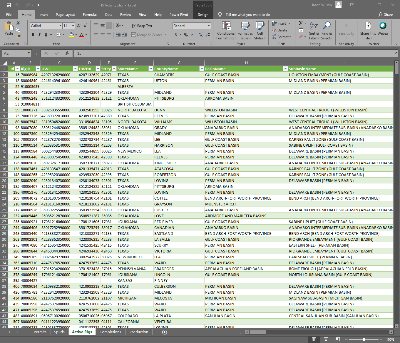
Conduit System of Access for Excel
The Conduit for IHS Markit data comes complete with auto-updated Microsoft Excel and Tibco Spotfire templates for the recent permit, spud, rig, completion, and production activity. These are updated daily in SQL Server and refresh automatically upon launching the template.
Conduit System Of Access for ArcMap/ArcGIS Pro
The Conduit for IHS Markit data comes complete with a ready-to-run Esri ArcMap template for all your entitled data. These datasets are maintained in SQL Server Spatial tables and are performance-tuned and tested for ArcMap, ArcGIS Pro, ArcGIS Server, and Portal.

Conduit System of Access for Spotfire
We provide a Tibco Spotfire template that loads our compiled Conduit Well Oneline with pre-built completion and production aggregations. This template loads and refreshes the data in Spotfire upon launching the template pulling new data directly from the Conduit updated SQL Server database.

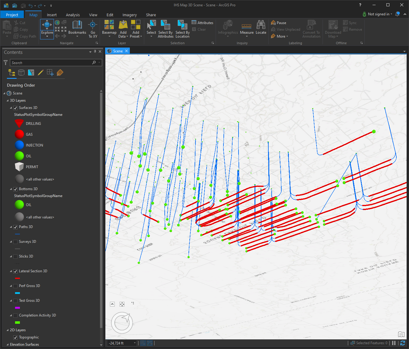
Conduit System Of Access For 3D ArcScene
The Conduit for IHS Markit data comes complete with a ready-to-run Esri ArcGIS Pro 3-Dimensional template. This data is designed specifically for showing the wellbore, lateral section, perforated gross interval, and treated gross interval in the subsurface.
IHS Markit Land Grid and Fee Lease Data
The Conduit for IHS Markit Land data comes complete with a ready-to-run Esri ArcMap templates for all your entitled grid and lease data. These datasets are maintained in SQL Server Spatial tables and are performance-tuned and tested for ArcMap, ArcGIS Pro, ArcGIS Server, and Portal.

